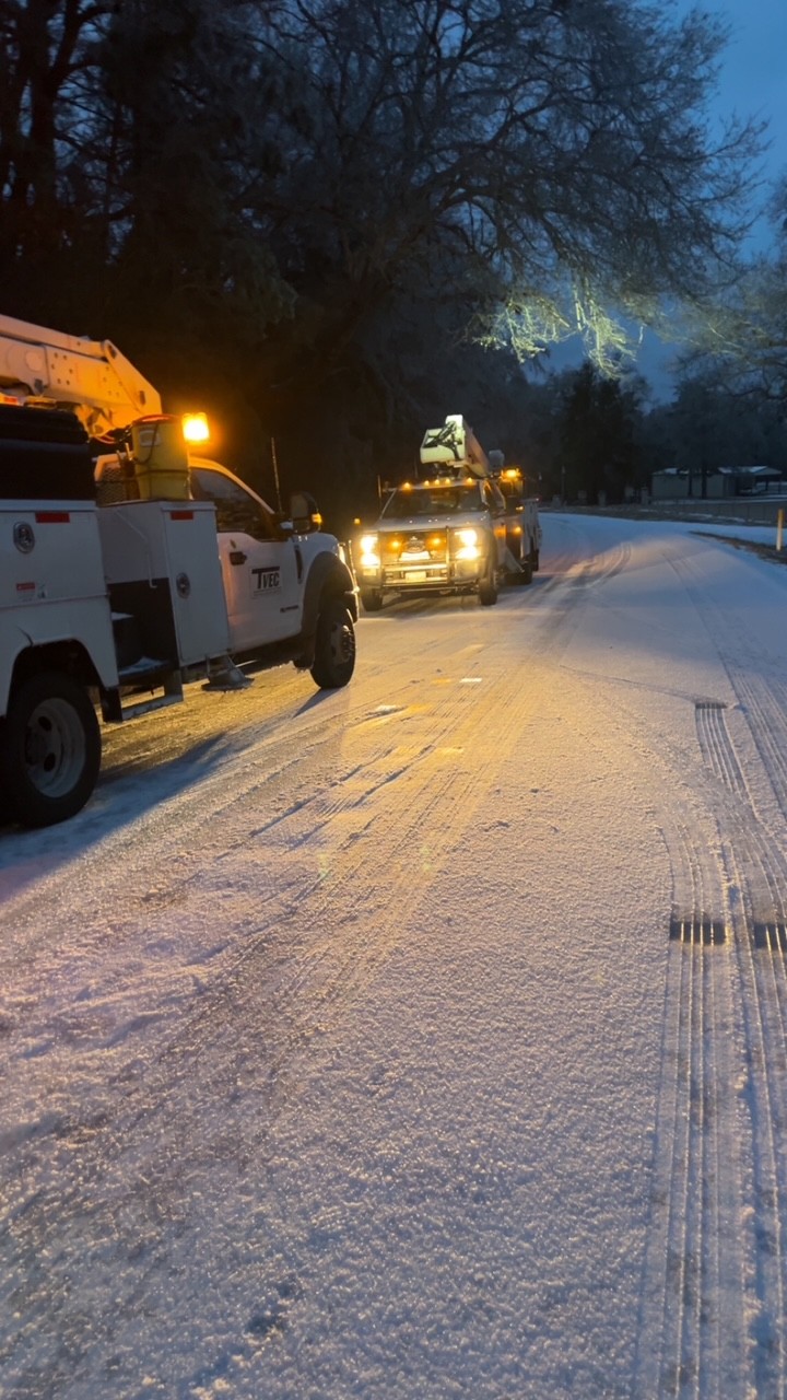
10 a.m. 1/25/26 – The TVEC service area seems to have been spared the heavy ice buildup that is causing major power disruptions from east Texas to Tennessee and beyond this morning. We have seen some scattered power outages, mostly from leaning and fallen trees.
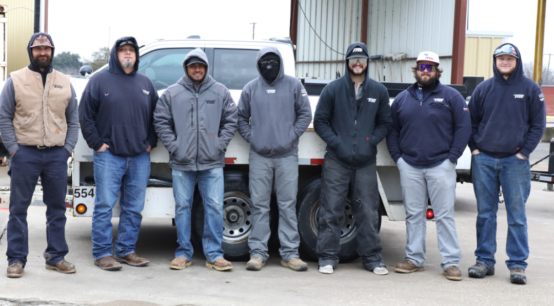
We owe a big thanks to our crews and tree contractors who have been working continuously with preventative cutting and quickly responding to outages!
With the forecast of record low temperatures for the next few nights, engineers and system operators will be working to make sure that the high electrical demand is met and accommodated by our infrastructure. This sometimes requires shifting load between lines, incurring brief line outages.
DO report any outages, however, at 800-967-9324, in SmartHub or via outage texting. Our meter system does not have the capability to self-report outages.
A note on the grid – ERCOT has not predicted any need for rolling outages or other measures for grid reliability. We have seen messages being passed around that are fake or scams. If something happened that required such drastic response we would communicate that to you. You may also check current grid conditions at ercot.com or in the Ercot mobile app.
As always, we urge you to be safe on the roads and watch out for our crews while you are out. Car wrecks pose a hazard to workers AND to the power lines.. keep those cars on the road, or just stay in if at all possible.
Original Post: TVEC members Keeping our members informed, prepared, and safe during severe weather is a top priority. Below you will find important information about crew safety, outage reporting, winter weather impacts, and how you can prepare your household.
Check your inbox for the latest information.
Our Crews Work in Challenging Conditions
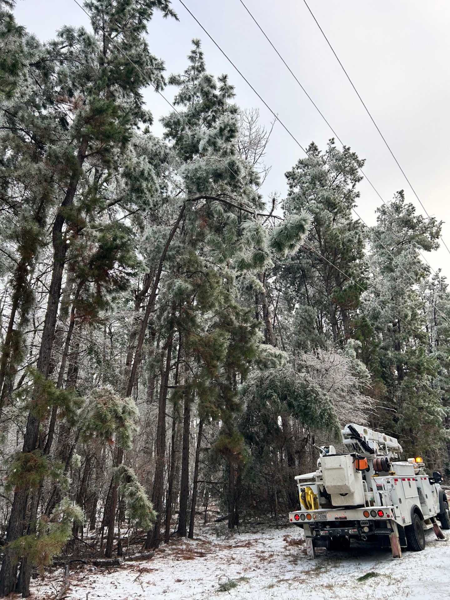
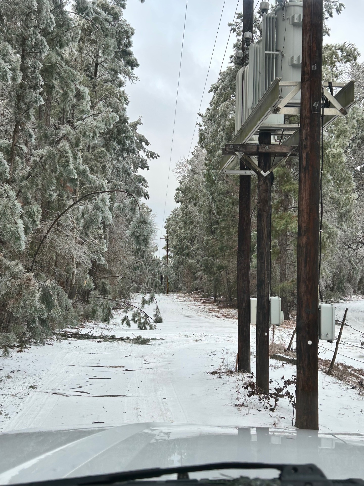
During severe weather, our lineworkers and field crews face real hazards on every call. Ice, strong winds, low visibility, traffic, and energized lines create dangerous working conditions. They continue to respond because they care deeply about the communities they serve.
How Members Can Help Keep Crews Safe
You can play an important role in protecting our crews by following these simple actions:
- Slow down and move over when you see utility trucks on the roadside
- Stay clear of downed power lines at all times
- Report outages and hazards through SmartHub or official reporting channels
- Secure pets when crews are working near your home
- Show patience as crews work through difficult conditions safely
Restoring power matters. Making sure everyone gets home safely matters even more.
We are here for you, and we sincerely thank you for supporting our crews.
How Ice Impacts Power Lines During Winter Weather
As winter weather moves into our area, you may experience outages or flickering lights. One common cause is ice buildup on power lines.
When freezing rain coats power lines, the added weight puts significant strain on the system. Ice accumulation can cause lines to sag, poles to lean, and in severe cases, lines to break. Strong winds can worsen these impacts by placing even more stress on already heavy lines.
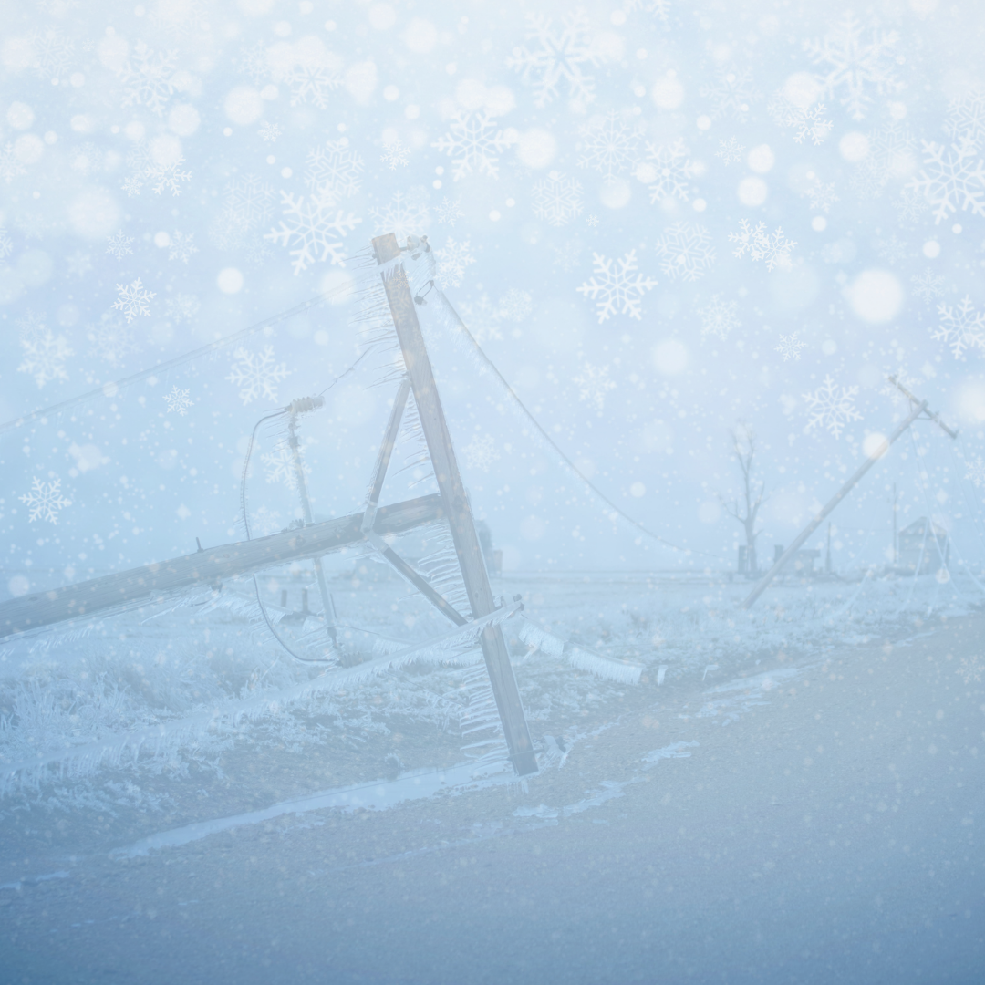
Ice can also cause tree limbs to snap and fall into power lines, which is one of the most frequent causes of outages during winter storms.
Our crews closely monitor conditions and are prepared to respond as quickly and safely as possible. If you experience an outage, please report it using official TVEC reporting methods so restoration can be prioritized.
Always assume a downed power line is energized and dangerous. Stay away and report it immediately.
Outage Reporting, Safety, and Restoration Expectations
Reporting outages correctly helps our crews respond faster and more efficiently.
How to Report an Outage
- Call 1-800-967-9324 for 24-hour outage reporting
- Text OUT to 972-932-2214 if you are enrolled in texting services
- Visit tvec.net/outage-center to report online
- Report outages in SmartHub
Please do not report outages through social media. Those reports do not reach our outage system and can delay response.
Safety Always Comes First
- Always assume downed power lines are energized and dangerous. Stay far away and report them to TVEC or call 911
- Avoid unnecessary travel during severe weather when possible
- Use generators safely and never operate them indoors
- Unplug sensitive electronics and turn off major appliances to reduce the risk of damage when power is restored.
How We Restore Power
Our crews follow a structured, safety-focused restoration process:
- Damage assessment begins
- Critical services such as hospitals and emergency facilities are restored first
- Substations and main lines are repaired next to restore power to the greatest number of members
- Individual tap lines and smaller outages are addressed last
If you see crews nearby but your power is still out, they may be working on infrastructure that must be repaired first to safely restore your service.
We appreciate your patience, preparedness, and partnership during outage events.
Winter Driving Safety Tips
With the potential for winter weather approaching, please take extra precautions if you must be on the road.
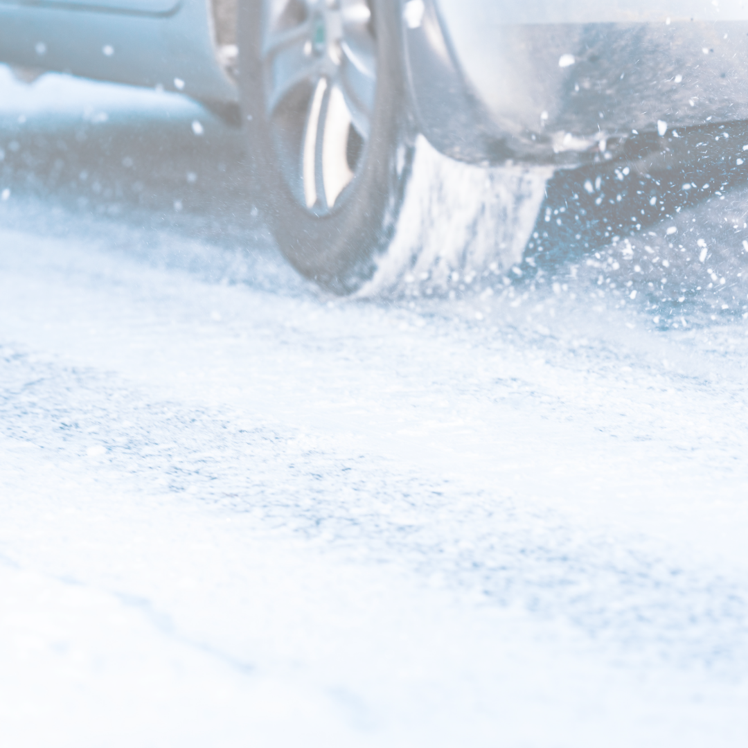
- Reduce speed and allow plenty of space between you and other vehicles. On icy roads, you may need three times the normal stopping distance
- Avoid sharp turns or sudden braking. Gentle movements help prevent sliding
- If your vehicle begins to slide, ease off the gas or brakes and steer in the direction of the skid until traction returns
- From a complete stop, accelerate slowly. Starting in second gear can help improve traction
- Keep sand, kitty litter, or cardboard in your vehicle to help regain traction if you become stuck
- Carry an emergency kit that includes blankets, water, jumper cables, a flashlight, warning devices such as flares or emergency markers, and a tow rope, especially when traveling in rural areas
- Check local weather and traffic reports before traveling. If road conditions are poor, consider postponing non-essential trips
Winter Storm Planning and Preparedness
Now is the time to prepare, not panic. Simple steps taken ahead of time can make a meaningful difference.
Our teams prepare year-round by inspecting equipment, reviewing response plans, and ensuring crews are ready to respond when outages occur.
Steps You Can Take to Prepare
- Build an emergency kit with flashlights, batteries, water, and nonperishable food
- Keep phones and backup chargers fully charged
- Know how to report an outage
- Never use generators, grills, or heaters indoors
- Keep space heaters at least three feet away from anything flammable
- Check on elderly neighbors and family members
Preparedness protects your household and your community.
Remember the 4 Ps of Winter Preparedness
- People: Check on elderly neighbors and loved ones
- Pets: Bring animals indoors and ensure they have warm shelter
- Plants: Cover outdoor plants before temperatures drop
- Pipes: Protect exposed pipes to prevent freezing and costly damage
Weather Outlook
Members should be aware of a significant shift in weather conditions expected over the next several days. While midweek remains mild, colder temperatures and winter precipitation are expected heading into the weekend.
Midweek Conditions (Today through Thursday)
Showers are possible today, mainly before noon, with temperatures near 61 degrees. Conditions remain mostly cloudy but mild through Thursday, with highs around 61 and overnight lows in the mid-40s. Rain chances increase late Thursday night, with a slight chance of thunderstorms after midnight.
Friday: Turning Colder
Rain is likely throughout the day Friday. Temperatures are expected to fall into the mid-30s by late afternoon. Northeast winds will increase with gusts up to 25 mph. Conditions will continue to worsen into the evening.
Friday Night through Saturday: Highest Impact Period
Friday night brings the greatest concern as rain is expected to change over to sleet and freezing rain. Overnight temperatures could fall near 20 degrees. Saturday is expected to remain very cold, with a high near 24 and continued sleet and freezing rain possible throughout the day. Travel conditions could become dangerous.
Sunday into Early Next Week
A slight chance of snow or sleet remains Sunday morning, followed by very cold temperatures. Highs Sunday and Monday are expected to remain in the 20s and 30s, with overnight lows in the single digits and teens. Cold conditions are expected to continue into Tuesday.
What This Means for You
Now is a good time to begin preparing for possible winter weather impacts. Continue to monitor updates from local weather sources and from our cooperative as conditions develop.
We’ve got generator safety tips & how to keep your loved ones safe in our latest January member email.
Don’t forget to check your inbox for the winter storm notification to members.
Follow us on Facebook for updates throughout the storm.
We are Here. For You.